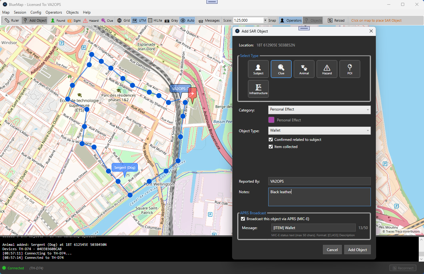
A desktop APRS tracking and mapping application designed for real-time station tracking and Search & Rescue operations. Built on .NET 8 for Windows, with Bluetooth and Direwolf TNC connectivity.
What It Does
BlueMap connects to a growing list of transceivers via Bluetooth KISS TNC or to a Direwolf software TNC over TCP/IP. Currently supported radios include the Kenwood TH-D74, TH-D75, VGC N-76, and BHTech UV-PRO, with more on the way (including the Kenwood TM-D750A). It receives and decodes APRS packets in real time, displays stations on an interactive tiled map, and provides a full SAR evidence management system for field operations.
The application supports multiple map tile sources with offline caching, making it fully operational in the field without internet connectivity. Sessions can be saved, loaded, and exported to PostgreSQL for post-operation analysis.
Key Features
Real-time APRS station tracking on interactive tiled maps
Bluetooth KISS TNC connectivity for Kenwood TH-D74/D75, VGC N-76, and BHTech UV-PRO
Direwolf KISS-over-TCP connectivity for software TNCs
SAR object management — subjects, clues, hazards, POIs, infrastructure
Operator tracking with configurable colors and movement trails
Multiple map sources with SQLite tile caching for offline use
UTM grid overlay and coordinate systems for SAR operations
APRS message composition and inbox
Distance measurement tool
CSV and GeoJSON export for SAR evidence
Session save/load and PostgreSQL export
Bilingual support — English and French
Military map scale presets (1:2,500 to 1:250,000)
Automatic reconnection with exponential backoff
SAR Object System
BlueMap includes a comprehensive evidence management system built for Search & Rescue teams. Objects are organized into categories — subjects, clues (clothing, personal effects, track signs), animals, hazards, points of interest (PLS, LKP, IPP), and infrastructure. Each object records location, finder, timestamp, and notes.
SAR data can be exported to CSV for spreadsheets or GeoJSON for GIS applications like QGIS, ArcGIS, and Google Earth, enabling seamless integration with existing SAR workflows.
System Requirements
Windows 10 or later
.NET 8.0 Desktop Runtime
Bluetooth-capable PC (for Bluetooth KISS TNC connections)
Network adapter (Ethernet or Wi-Fi) for networked KISS TNC connections
Internet connection for online tiles, or pre-cached tiles for offline
Looking for a ready-to-go KISS TNC setup? Our LiaisonOS comes with Direwolf and all the networking tools pre-configured, giving you a complete TCP KISS TNC solution out of the box — just boot and connect.